martes, 19 de diciembre de 2023

Felices Navidades y Año Nuevo 2024 / Merry Christmas and Happy New Year 2024

Queremos desearles felices Navidades y lo hacemos con este conocido villancico interpretado por cantantes israelíes y palestinos. Todo un símbolo de que debería ser posible vivir en paz. Al menos durante estas fiestas.

We want to wish you a merry Christmas with this well known Christmas carol that is performed by Israeli and Palestinian singers. A symbol that it should be possible to live in peace. At least during this holiday season.

El tamborilero / Little Drummer Boy - Voices from Bethlehem

jueves, 30 de noviembre de 2023

El submarino S-81 Isaac Peral entregado a la Armada / The submarine S-81 Isaac Peral delivered to the Armada

El 30 de noviembre de 2023, el submarino S-81 Isaac Peral se entregó por fin a la Armada. La entrega tuvo lugar en Cartagena. Es la primera unidad de una serie de cuatro de la denominada Clase S-80 Plus, el más moderno diseño de un submarino no nuclear. 

Puede ver algunas de sus características en el siguiente vídeo (2'18"), cortesía de Infodefensa TV.

On November 30, 2023, the S-81 Isaac Peral submarine was finally delivered to the Armada. The delivery took place in Cartagena. It is the first unit of a series of four of the so-called S-80 Plus Class, the most modern design of a non-nuclear submarine.

You can see some of its features in the following video (2'18"), courtesy of Infodefensa TV.

Clic para ampliar / Click to enlarge
Entradas relacionadas / Related posts
El submarino S-81 Isaac Peral / The submarine S-81 Isaac Peral
Armamento, equipos y sistemas del S-81 Isaac Peral, el primer submarino para la Armada en 38 años
El submarino Peral / The submarine Peral
125 aniversario del submarino Peral / 125th anniversary of the submarine Peral

miércoles, 22 de noviembre de 2023

HACIENDA RIQUELME SL

¿Qué sabemos de la empresa propietaria de El Casón? 

Según se puede ver en la web DATOSCIF, se trata de una empresa valenciana con un capital social de 3.030 €. Sus actividades son contabilidad, teneduría de libros, auditoría y asesoría fiscal. Se constituyó el 14 de febrero de 2022. Su objeto social y los nombres de sus directivos aparecen también en el enlace anterior.

En el gráfico siguiente se muestra la relación de los directivos de HACIENDA RIQUELME SL con otras 15 empresas. Use el mismo enlace para conseguir información de cada una.

What do we know about the company that owns El Casón?

According to the website DATOSCIF, it is a Valencian company with a share capital of 3,030 €. Its activities are accounting, bookkeeping, auditing and tax consultancy. It was incorporated on February 14, 2022. Its corporate purpose and the names of its directors also appear in the previous link.

The following chart shows the relationship of the directors of HACIENDA RIQUELME SL with 15 other companies. Use the same link to get information on each of them.

Vinculaciones de HACIENDA RIQUELME SL y mapa de directivos con sus relaciones con otras empresas. Haga clic sobre la imagen para ampliarla.
Links of HACIENDA RIQUELME SL and map of managers with their relationships with other companies. Click on the image to enlarge it.

lunes, 30 de octubre de 2023

A quick British translation guide / Una guía rápida de traducción del británico

In the post What the British say, what they really mean, and what others understand we already saw that the British themselves acknowledge that it can be difficult to understand what they really mean. Here we find another fun example.

It’s hard saying no. So luckily the Brits have devised a million ways to say it without actually saying it. And with this translation T-shirt, you won’t even have to say it out loud! Wear your refusals with pride.

This T-shirt can be found at Very British Problems Official Shop

En la entrada Lo que los británicos dicen, lo que realmente quieren decir y lo que otros entienden ya vimos que los propios británicos reconocen que puede resultar difícil entender lo que realmente quieren decir. Aquí encontramos otro ejemplo divertido.

Es difícil decir que no. Afortunadamente, los británicos han ideado un millón de formas de decirlo sin decirlo. ¡Y con esta camiseta con traducción ni siquiera tendrás que decirlo en voz alta! Lleva tus negativas con orgullo.

Esta camiseta se puede encontrar en Very British Problems Official Shop.

domingo, 1 de octubre de 2023

Sucina. Boletín El Gavilán nº16 / El Gavilán (The Hawk) newsletter nº16

El nº 16 del Boletín El Gavilán ya está disponible. Si le interesa la historia de Sucina y su gente, no encontrará forma más fácil y amena de conocerla que leyendo esta publicación trimestral.

Todos los boletines se pueden descargar libremente desde este enlace.

Issue No. 16 of El Gavilán newsletter is available. If you are interested in the history of Sucina and its people, you will find no easier and more enjoyable way to learn about it than reading this quarterly publication.

Every newsletter can be freely downloaded from this link.

viernes, 18 de agosto de 2023

1000 posts

La primera entrada (post) de este blog se publicó el 12 de marzo de 2010. Ésta, subida el 18 de agosto de 2023, es la número 1000.

En todos estos años, en Hacienda Riquelme han pasado muchas cosas, unas buenas y otras no tanto, pero continuamos la andadura.

Todos los posts, y las 14 páginas de las que consta el blog, contienen una gran cantidad de información sobre el resort, sobre los valores naturales y medioambientales que nos rodean y sobre Historia. Algunas páginas y entradas conservan su utilidad e interés mientras que otras se han quedado obsoletas. La ventaja de un blog es que se puede recuperar fácilmente cualquier cosa y en cualquier momento, con independencia de cuándo se publicó.

Entre las páginas más visitadas, están Historia de Hacienda Riquelme, Sucina. Servicios disponibles y Sobre el resort, donde hallará muchos datos y planos, algunos de reciente elaboración, como el de las piscinas. A los interesados en la Historia, el Índice de entradas sobre Historia les resultará muy útil. Podrá leer sobre hechos, a menudo ocurridos en la Región de Murcia, y también sobre derrotas británicas en enfrentamientos con españoles.

Entre las entradas más populares citaremos Los nombres de los edificios de Hacienda Riquelme, Las aves en Hacienda Riquelme a través de los años y ¿Por qué hemos criticado la política de jardinería del resort?, que esperamos contribuya a que no se vuelvan a producir los conflictos que la originaron. Los hoyos del campo de golf vistos desde un drone seguro que será del agrado de los golfistas. Lo que los británicos dicen, lo que realmente quieren decir y lo que otros entienden quizá contribuya a un mejor entendimiento entre propietarios de diferentes nacionalidades.

Le sugerimos que navegue por el blog y use el buscador y los índices. Encontrará textos, fotos y vídeos que en algún caso le sorprenderán.
The first post in this blog was published on March 12, 2010. This one, uploaded on August 18, 2023, is the number 1000.

Throughout these years, many things have happened at Hacienda Riquelme, some good and others not so good, but we continue our journey.

Every posts, and the 14 pages that make up the blog, contain a large amount of information about the resort, about the natural and environmental values that surround it and about History. Some pages and posts retain their usefulness and interest while others have become outdated. The advantage of a blog is that you can easily retrieve anything at any time, regardless of when it was posted.

Among the most visited pages are History of Hacienda Riquelme, Sucina. Available Services and About the resort, where you will find many details and plans, some of which have been recently drawn up, such as the one for the swimming pools. Those interested in History will find the Index of posts about History very useful. You will be able to read about events, often occurring in the Region of Murcia, and also about British defeats in clashes with the Spanish.

Among the most popular posts we will mention The names of the buildings of Hacienda Riquelme, Birds in Hacienda Riquelme through the years and Why have we criticized the resort's gardening policy?, which we hope will help prevent the occurrence of the conflicts that gave rise to it. The holes of the golf course seen from a drone by sure will be liked by golfers. What the British say, what they really mean, and what others understand perhaps will contribute to a better understanding between owners of different nationalities.

We suggest you browse the blog and use the search engine and indexes. You will find texts, photos and videos that in some cases will surprise you.

miércoles, 16 de agosto de 2023

Las piscinas de Hacienda Riquelme / The pools of Hacienda Riquelme

Si quiere saber dónde está una piscina, su forma, tamaño y número identificativo, puede usar este plano. Esperamos le resulte útil.

If you want to know where a pool is, its shape, size and identifying number, you can use this plan. We hope you find it useful.

Haga clic para ampliar el plano y clic derecho para descargar el archivo (21 MBytes) a máxima resolución
Click to enlarge the plan and right click to download the file (21 MBytes) at full resolution

lunes, 14 de agosto de 2023

Árboles singulares en Hacienda Riquelme / Singular trees on Hacienda Riquelme

Los jardines de Hacienda Riquelme incluyen algunos árboles singulares. Localizamos tres:

  • Ceiba speciosa. La de la fotografía está junto al Casón. Hay varias más pequeñas en una rotonda de la calle Índico.
  • Pino canario. Ejemplar único en el resort. Es de hoja perenne.
  • Álamo blanco. Es un gran ejemplar, único en Hacienda Riquelme. Frecuente en España, aquí es raro porque necesita bastante agua. Probablente se ha desarrollado porque está junto al estanque de tormentas del resort.

Los fotografiamos el 30 de abril de 2022 y el 4 de agosto de 2023.

The gardens of Hacienda Riquelme include some unique trees. We located three:

  • Ceiba speciosa. The one in the photograph is next to the Casón. There are several smaller ones at a roundabout on Índico street.
  • Canary Island pine. Unique specimen in the resort. It is evergreen.
  • White poplar. It is a great specimen, unique in Hacienda Riquelme. Frequent in Spain, here it is rare because it needs a lot of water. It's probably grown because it's next to the resort's storm pond.
We took pictures on April 30, 2022 and August 4, 2023.
 

Ceiba speciosa en primavera y en verano / Ceiba speciosa in spring and in summer


Tronco de ceiba speciosa y pino canario / Trunk of ceiba speciosa and Canary Island pine


Álamo blanco en primavera y en verano / White poplar in spring and in summer


sábado, 12 de agosto de 2023

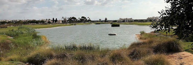
Los cinco lagos de Hacienda Riquelme (14) / The five lakes in Hacienda Riquelme (14)

Las fotos siguientes se tomaron el 4 de agosto de 2023. La turbulenta evolución de los lagos desde 2011 hasta la actualidad la puede ver en la página Los 5 lagos de Hacienda Riquelme.

The photos below were taken on August 4, 2023. The turbulent evolution of the lakes from 2011 to the present day can be seen in the page The 5 lakes in Hacienda Riquelme.

Lake 1 (holes 4 and 5) / Lago 1 (hoyos 4 y 5)

Lake 2 (hole 7) / Lago 2 (hoyo 7)

Lake 3 seen from El Casón / Lago 3 visto desde El Casón

Lake 3 seen from Phase 1 / Lago 3 visto desde la Fase 1

Lake 4 (holes 11 and 16) / Lago 4 (hoyos 11 y 16)

Lake 5 (Phase 2) / Lago 5 (Fase 2)

miércoles, 9 de agosto de 2023

Las raíces hispanas de los Estados Unidos (para lectores con poco tiempo) / The Hispanic Roots of the United States (for readers with little time)

En la entrada Las raíces hispanas de los Estados Unidos dijimos que, para dar a conocer la historia en común que esta gran nación y España tienen, la Asociación Cultural Héroes de Cavite había editado una revista monográfica bilingüe (español e inglés). En ella se resumen los múltiples aspectos de esa historia, pero ciñéndose a la realidad de los hechos y tratando de explicarlos de una forma objetiva, clara y concisa.

Las personas que disponen de poco tiempo, tienen ahora la posibilidad de leer la revista en píldoras: un artículo por cada capítulo, simplificado, sin notas a pie de página y en un solo idioma. Puede encontrarlos en los siguientes enlaces:

  1. Las fronteras compartidas por la Monarquía Hispánica y USA
  2. Exploraciones y descubrimientos españoles en el Golfo de México y la costa atlántica USA
  3. Exploraciones y descubrimientos españoles en la costa del Pacífico USA
  4. Exploraciones y descubrimientos españoles en el interior de USA
  5. Ciudades y caminos reales españoles en USA
  6. Legado español en la cultura, idioma y religión de USA
  7. Contribución española a la independencia de USA
  8. Arte, toponimia y símbolos españoles en USA

Otras entradas relacionadas:

Otros sitios web recomendados:

La cruz de Borgoña o cruz de San Andrés fue la bandera de los ejércitos de la Monarquía Hispánica  durante tres siglos. Hoy en día sigue estando presente en pendones y escudos de muchas unidades militares españolas.
The Burgundy cross or St. Andrew's cross was the flag of the Hispanic Monarchy armies for three centuries. Today it is still present on the banners and coats of many Spanish military units.
La bandera de los Estados Unidos de América fue incrementando el número de estrellas según aumentaba el de estados de la Unión.
The flag of the United States of America increased the number of stars as the number of states in the Union increased.

In the post The Hispanic Roots of the United States we said that, in order to make known the common history that this great nation and Spain have, the Asociación Cultural Héroes de Cavite had published a bilingual (Spanish and English) monographic magazine. It summarizes the multiple aspects of that history, but sticking to the reality of the facts and trying to explain them in an objective, clear and concise way.

People who are short of time now have the possibility to read the magazine in pills: one article for each chapter, simplified, without footnotes and in one language only. You can find them in the following links:

  1. The Shared borders between the Hispanic Monarchy and the U.S.
  2. Spanish explorations and discoveries in the Gulf of Mexico and the U.S. Atlantic coast
  3. Spanish explorations and discoveries on the Pacific coast of the U.S.
  4. Spanish explorations and discoveries inland U.S.
  5. Spanish Cities and Caminos Reales (Royal Roads) in the U.S.
  6. Spanish legacy in U.S. culture, language and religion
  7. Spanish contribution to U.S. Independence
  8. Spanish art, toponymy and symbols in the U.S.

Other related posts:

Other recommended websites:

martes, 8 de agosto de 2023

Shared borders between the Hispanic Monarchy and the U.S.

Versión en español

The Hispanic Monarchy ruled over much of the current United States. It had an actual presence and exercised genuine administration in Florida, Texas, New Mexico, southern Arizona and California, as well as in a part of an immense territory with poorly defined borders known as Louisiana, located mostly west of the Mississippi River. This presence in North America lasted more than three centuries. During that time, Hispanics explored, colonized and brought their culture, language and religion to those lands. They also shared borders. We talk about all this below.

The Seven Years' War (1756-1763) can be considered to be a first world war, actually a series of conflicts, in which almost all European countries participated. It was fought throughout many parts of the world. The part of the Seven Year's War that took place in North America is known as the French and Indian War and was motivated by English intentions to expand its colonies at the expense of the French. Spain entered the war late and ill-prepared under France's leadership. In the Treaty of Paris of 1763, which put an end to hostilities, Spain lost East and West Florida, which passed into British hands. France, which lost Canada and its possessions east of the Mississippi, ceded Louisiana to Spain as compensation.

Despite its victory, Great Britain emerged with its economy in battered condition and decided to raise taxes, which, together with trade restrictions imposed by the mother country and the desire for freedom derived from Enlightenment ideas, caused great unrest in its American colonies. This increased with the Royal Proclamation of 1763, which prohibited colonization beyond the west of the Appalachian Mountains to prevent depopulation in Atlantic coast settlements and settler conflicts with Indian tribes. Some of those who would later become rebel leaders, such as George Washington and Thomas Jefferson, had explored and acquired thousands of acres along the upper Potomac and Ohio and in western Virginia in previous years. The prohibition harmed their interests and rights and was a major reason for the insurrection, which finally took place in 1775. France and Spain supported the insurgents.
Borders After the Treaty of Paris and the Royal Proclamation of 1763. British territory between the Appalachians and the Mississippi was an Indian reserve.
Map based on one by John Francis (Wikipedia Commons)
The Treaty of Paris of 1783, signed by Great Britain, the United States, France and Spain, recognized the independence of the Thirteen Colonies and gave Florida back to Spain. However, the Spanish territorial claims by right of conquest on the eastern bank of the Mississippi, or its exclusive right of navigation on this river, were not taken into consideration. This happened because one of the representatives of Congress traveled from Paris to London and signed a preliminary treaty with the former mother country in which England awarded territories that no longer belonged to it and allowed freedom of navigation on a river that it did not control. This meant going back to the situation of the peace of 1763. The Hispanic Monarchy and the United States now shared a border, but also a dispute related to it.
The Viceroyalty of New Spain in 1795. The Captaincy General of the Philippines, which included the Philippines, Guam and other islands under Spanish sovereignty in the Pacific, was also part of the Viceroyalty of New Spain.

After many years of fruitless negotiations between the Spanish Crown and the new state, the Treaty of San Lorenzo de El Escorial was finally signed in 1795 and ratified by George Washington and Charles IV in 1796, which defined the border between the United States and north of Florida. The border with Louisiana already was located at the Mississsipi River. Spain gave up much of what it gained during the war and agreed to free navigation on that river for Americans and Spaniards.

By the Third Treaty of San Ildefonso, Spain ceded Louisiana in 1803 to the France of Napoleon, which immediately sold it to the young nation. According to Spanish diplomacy, the sale of Louisiana was null and void, since Napoleon did not comply with the signed conditions, which included the non-alienation of the territory to a country other than Spain. But nothing could be done to avoid it.

In the following years, United States westward expansion provoked new grievances and territorial conflicts with Spain. The Adams-Onís Treaty, named after the representatives of each country who conducted the negotiations, Secretary of State John Quincy Adams and Luis de Onís, representative of Fernando VII, signed in 1819 and ratified in 1821, established the new borders between the two nations.. On the eve of Mexico's independence, a large part of what is now the United States was still recognized as Spanish territory. But for Spain, it was the last chapter of a story that had begun 300 years earlier.
The Borders Agreed to in the Adams-Onís Treaty (1819).

Text extracted from The Hispanic Roots of the United States by courtesy of Asociación Cultural Héroes de Cavite.

Las fronteras compartidas por la Monarquía Hispánica y USA

English version

La Monarquía Hispánica tuvo un dominio sobre gran parte de los actuales Estados Unidos. La presencia real y la administración efectiva la ejerció en Florida, Texas, Nuevo México, sur de Arizona y California. También en parte de un inmenso territorio de fronteras difusas conocido como la Luisiana, situado en su mayor parte al oeste del río Misisipi. Esa presencia en Norteamérica duró más de tres siglos. Durante ese tiempo, los hispanos exploraron, colonizaron y llevaron su cultura, idioma y religión a aquellas tierras. También compartieron fronteras. De esto último hablaremos ahora.

La guerra de los Siete Años (1756-1763) se puede considerar como una primera guerra mundial, en realidad una serie de conflictos, en los que participaron casi todos los países europeos y se combatió por muchas partes del planeta. La parte que se desarrolló en América del Norte se la conoce como guerra Franco-India (French and Indian War) y estuvo motivada por las intenciones inglesas de expandir sus colonias a costa de los franceses. España entró en la guerra tarde y mal preparada de la mano de Francia y, en el tratado de París de 1763 que puso fin a las hostilidades, perdió la Florida Oriental y Occidental, que pasaron a manos británicas. Francia, que perdió Canadá y sus posesiones al este del Misisipi, cedió la Luisiana a España como compensación.

A pesar de la victoria, Gran Bretaña salió con la economía malparada y decidió subir los impuestos lo que, junto a restricciones al comercio impuestas por la metrópoli y deseos de libertad derivados de las ideas ilustradas, provocó un gran malestar en sus colonias americanas. Éste aumentó con la Proclamación Real (Royal Proclamation) de 1763, que prohibía la colonización al oeste de los montes Apalaches para evitar la despoblación en los establecimientos de la costa atlántica y los conflictos de los colonos con las tribus indígenas. Algunos de los que luego serían líderes rebeldes, como George Washington y Thomas Jefferson, habían explorado y adquirido en años anteriores miles de hectáreas en la parte superior del Potomac y el Ohio y en el oeste de Virginia. La prohibición dañaba sus intereses y derechos y fue un motivo importante para la insurrección, que finalmente se produjo en 1775. Francia y España apoyaron a los insurgentes.
Las fronteras tras el tratado de París y la proclamación real de 1763. El territorio británico entre los Apalaches y el Misisipi era reserva india.
Mapa basado en uno de John Francis (Wikipedia Commons)
El tratado de París de 1783, firmado por Gran Bretaña, los Estados Unidos, Francia y España, reconocía la independencia de las Trece Colonias y España recuperaba la Florida. Pero no se tomaban en consideración las reclamaciones territoriales españolas por derecho de conquista en la orilla oriental del Misisipi, ni el derecho de navegación exclusiva por este río. Esto se debió a que uno de los representantes del Congreso viajó de París a Londres y firmó con la antigua metrópoli un tratado preliminar en el que Inglaterra adjudicaba territorios que ya no eran suyos y permitía la libertad de navegación por un río que no controlaba. Esto significaba retrotraerse a la situación de la paz de 1763. La Monarquía Hispánica y los Estados Unidos compartían ahora frontera, pero también un contencioso relacionado con ella.
El virreinato de Nueva España en 1795. La Capitanía General de Filipinas, que incluía a las Filipinas, Guam y otras islas de soberanía española en el Pacífico, también formaba parte del virreinato de Nueva España.

Tras muchos años de estériles negociaciones entre la corona española y el nuevo estado, finalmente se firmó el tratado de San Lorenzo de El Escorial en 1795, ratificado por George Washington y Carlos IV en 1796.  En él se definió la frontera entre Estados Unidos y el norte de Florida. La frontera con Luisiana ya estaba en el río Misisipi. España cedió gran parte de lo ganado durante la guerra y se acordó la libre navegación por dicho río para estadounidenses y españoles.

Por el tercer tratado de San Ildefonso, España cedió Luisiana en 1803 a la Francia de Napoleón, quién de inmediato se la vendió a la joven nación. Según la diplomacia española, la venta de Luisiana fue nula de pleno derecho, al incumplir Napoleón las condiciones firmadas, que incluían la no enajenación del territorio a otro país que no fuera España. Pero nada pudo hacerse por evitarla.

En los siguientes años, la expansión norteamericana hacia el oeste provocó nuevas reclamaciones y conflictos territoriales con España. El tratado de Adams-Onís, llamado así por los representantes de cada país que llevaron las negociaciones, el secretario de Estado John Quincy Adams y Luis de Onís, representante de Fernando VII, firmado en 1819 y ratificado en 1821, estableció las nuevas fronteras entre ambas naciones. En vísperas de la independencia de México, todavía una gran parte de lo que hoy son los Estados Unidos se reconocía como territorio español. Pero para España fue el último capítulo de una historia que había empezado 300 años antes.
Las fronteras acordadas en el Tratado de Adams-Onís (1819).

Texto extraído y adaptado de Las raíces hispanas de los Estados Unidos por cortesía de la Asociación Cultural Héroes de Cavite.

lunes, 7 de agosto de 2023

Spanish explorations and discoveries in the Gulf of Mexico and the U.S. Atlantic coast

Versión en español

As early as the first half of the 16th century, Spanish sailors and explorers traveled and mapped the Gulf of Mexico and the East Coast of what is now the United States. Who did it and when is what we tell you below.

Juan Ponce de León, who had participated in the conquest of Puerto Rico in 1508, traveled the length of the east and southwest coasts of the Florida peninsula in 1513. From this trip came the first written reference to the Gulf Stream, which pilot Juan de Alaminos would study and would be of great importance for navigation from America to the Iberian Peninsula.

The North American coast of the Gulf of Mexico was explored by Alonso Álvarez de Pineda, who in 1519 sailed and created maps of the waters near of what are now the states of Florida, Alabama, Mississippi and Texas and discovered the mouth of the Mississippi River. His map is the oldest known document of this part of the United States.

In 1521, Ponce de León attempted to establish a settlement in Florida, but was unsuccessful and it cost him his life.

Lucas Vázquez de Ayllón sailed in 1520-1521, 1525 and 1526 along the coasts of the Atlantic Ocean, reaching North Carolina and Virginia. He founded San Miguel de Guadalupe (or Gualdape) in 1526. Its exact location is unknown, but some place it in Georgia and others in Virginia. It faced all kinds of difficulties and was dismantled a few months later.

Between 1524 and 1525, Esteban Gómez explored and mapped the Atlantic coast from the Labrador Peninsula to the Florida Peninsula, entering the Hudson River and what is now New York Harbour. For a long time, the northern half of the U.S. coast was designated on maps as “Tierra de Esteban Gómez” [Esteban Gómez’ Land].
Fragment of a copy the Map of the New World by Cartographer Diego Ribero (1529). Copy of the Library of Congress of the United States.
The map shows the Tierra de [Land of] Esteban Gómez, Tierra de Ayllón and the Tierra de Garay.
Francisco de Garay was responsible for organizing and sending out the expedition of Alonso Álvarez de Pineda.
A new attempt to colonize Florida was carried out by the expedition of Pánfilo de Narváez that landed near Tampa Bay in 1527. Hurricanes, native attacks, disease and starvation ended the expedition, which only five people survived.

Hurricanes also put an end to another attempt to settle in northwest Florida: at Pensacola by Tristán de Luna y Arellano between 1559 and 1561. The survivors then attempted to colonize Punta de Santa Elena, on the Atlantic coast, but with similar results.

In the end, it was Pedro Menéndez de Avilés who finally succeeded. He founded St. Augustine on the east coast of Florida in 1565. It is the first United States city founded by Europeans that has been continuously inhabited ever since.

In 1566, he founded Santa Elena on present-day Parris Island (South Carolina) which would be Florida’s first capital and the Spanish base of operations to the north. From there, the Jesuits carried out their missionary work and a series of ephemeral forts were founded, reaching the Appalachian Mountains.

Between 1566 and 1568, Juan Pardo carried out a last, failed attempt to colonize North and South Carolina.

In 1571, the destruction of Ajacán Mission, on the Virginia Peninsula, marked the end of Spanish plans to continue activity in the region. Santa Elena was definitively abandoned in 1587 and the capital moved to St. Augustine.

More than a century later, the coast of the Seno Mexicano [region along the Gulf of Mexico] from the Rio Grande to Florida was thoroughly explored and mapped between 1686 and 1689. Three land expeditions led by Captain Alonso de León the Younger and several more expeditions by sea were sent to locate a colony established on the Texas coast by Frenchman La Salle. During one of these expeditions, the first Texas missions were founded for the Caddos Indians.

In 1693, sailor Andrés de Pez managed to establish a settlement in Pensacola which would be fortified in the following years.
First Spanish Explorations in the United States (1513-1542).

Text extracted from The Hispanic Roots of the United States by courtesy of Asociación Cultural Héroes de Cavite.

Exploraciones y descubrimientos españoles en el Golfo de México y la costa atlántica USA

English version

En fechas tan tempranas como la primera mitad del siglo XVI, marinos y exploradores españoles recorrieron y cartografiaron el Golfo de México y la costa Este de lo que hoy son los Estados Unidos. Quiénes y cuándo lo hicieron es los que contamos a continuación.

Juan Ponce de León, que había participado en la conquista de Puerto Rico en 1508, recorrió las costas este y suroeste de la península de Florida en 1513. De este viaje es la primera referencia escrita a la Corriente del Golfo, que el piloto Juan de Alaminos estudiaría y sería de gran importancia para la navegación desde América a la península Ibérica.

La costa norteamericana del golfo de México fue explorada por Alonso Álvarez de Pineda, que navegó y levantó cartas en 1519 de las aguas próximas a lo que hoy son los estados de Florida, Alabama, Misisipi y Texas, y descubrió la desembocadura del río Misisipi. Su mapa es el documento más antiguo conocido de esta parte de los Estados Unidos.

En 1521, Ponce de León intentó establecer un asentamiento en Florida, pero no tuvo éxito y a él le costó la vida.

Lucas Vázquez de Ayllón navegó en 1520-1521, 1525 y 1526 por las costas del océano Atlántico llegando hasta Carolina del Norte y Virginia. En un lugar cuya localización exacta no se conoce y que unos sitúan en Georgia y otros en Virginia, fundó en 1526 San Miguel de Guadalupe (o de Gualdape) que, ante las dificultades de todo tipo encontradas, fue desmantelado a los pocos meses.

Entre 1524 y 1525, Esteban Gómez exploró y levantó mapas de la costa atlántica desde la península del Labrador hasta la península de Florida, entrando en el río Hudson y lo que hoy es el puerto de Nueva York. Durante mucho tiempo, la mitad norte de la costa de los EE. UU. fue nombrada en los mapas como «Tierra de Esteban Gómez».
Fragmento de una copia del Mapa del Nuevo Mundo del cartógrafo Diego Ribero (1529) existente en la Biblioteca del Congreso de Estados Unidos.
En el mapa aparecen las tierras de Esteban Gómez, de Ayllón y de Garay.
Francisco de Garay fue quién organizó y envió la expedición de Alonso Álvarez de Pineda.
Un nuevo intento de colonizar la Florida lo protagonizó la expedición de Pánfilo de Narváez que en 1527 desembarcó cerca de la bahía de Tampa. Los huracanes, los ataques de los nativos, las enfermedades y el hambre acabaron con la expedición de la que solo hubo cinco supervivientes.

También los huracanes acabaron con otro intento de establecerse en el noroeste de Florida, en Pensacola, llevado a cabo por Tristán de Luna y Arellano entre 1559 y 1561. Los supervivientes intentaron entonces colonizar Punta de Santa Elena, en la costa atlántica, pero con similar resultado.

Finalmente fue Pedro Menéndez de Avilés quién por fin tuvo éxito. En 1565, en la costa este de Florida fundó San Agustín, la primera ciudad de origen europeo de los Estados Unidos habitada sin interrupción desde su fundación.

En 1566, fundó Santa Elena, en el actual Parris Island (Carolina del Sur), que sería la primera capital de Florida y la base de operaciones española hacia el norte. Desde allí los jesuitas llevaron a cabo su labor misionera y se fundaron una serie de efímeros fuertes que llegaban hasta los Montes Apalaches.

Entre 1566 y 1568, Juan Pardo llevó a cabo un último y fallido intento de colonizar Carolina del Norte y del Sur.

En 1571, la destrucción de la misión de Ajacán, en la península de Virginia, marcó el fin de los planes españoles de continuar la actividad en la región. Santa Elena fue definitivamente abandonada en 1587 y la capital trasladada a San Agustín.

Más de un siglo después, entre 1686 y 1689, la costa del seno mexicano, desde el río Grande hasta Florida, fue minuciosamente explorada y cartografiada. Tres expediciones terrestres dirigidas por el capitán Alonso de León “El Joven” y varias más por mar se enviaron para localizar una colonia establecida en la costa de Texas por el francés La Salle. Durante una de esas expediciones se fundaron para los indios caddos las primeras misiones de Texas.

En 1693, el marino Andrés de Pez consiguió establecer un asentamiento en Pensacola que en los años siguientes sería fortificado.
Primeras exploraciones españolas en Estados Unidos (1513-1542).
Texto extraído y adaptado de Las raíces hispanas de los Estados Unidos por cortesía de la Asociación Cultural Héroes de Cavite.

domingo, 6 de agosto de 2023

Spanish explorations and discoveries on the Pacific coast of the U.S.

Versión en español

Juan Rodríguez Cabrillo sailed along the coast of California between 1542 and 1543, discovering San Diego and Monterey Bays. After he died as a result of a confrontation with the Indians, the expedition continued under the command of Bartolomé Ferrelo. It reached Cape Mendocino and sailed further north along the Oregon coast.

Since 1565, Spanish galleons crossed the Pacific between Acapulco and Manila once a year in each direction, thus initiating a first financial and commercial globalization between Asia, America and Europe. The trip from Acapulco to Manila took about three months and a stopover was made on the island of Guam, whereas the voyage from Manila to Acapulco was a very tough journey that could take four to six months. They would cross the Pacific with no stopovers and the first point of the American continent that they would sight was the aforementioned Cape Mendocino. From there the galleons made a relatively easy voyage, making use of the California Current. Finding a safe stopover right after crossing the ocean would be of great use. The galleons of 1584, 1587 and 1595 had instructions to explore that coast, but they were not able to find the desired refuge.
For 250 years, the Manila galleons sailed parallel to the California coast.
Tornaviaje [The Return Trip]. Painting by Carlos Parrilla Penagos.
In 1602-1603, Sebastián Vizcaíno traveled the same coasts as Cabrillo, creating meticulous maps, landing several times in Alta California and renaming some of the places discovered by his predecessor. As he was compelled to turn back due to scurvy, Martin de Aguilar pressed onward, eventually reaching the Oregon coast, which he was the first to detail in his journal.

Visitador General of New Spain José de Gálvez deemed the Russian advance from Alaska southward along the Pacific coast to be a threat, so in 1767 he promoted the expansion of Spain into Alta California. Vizcaíno's maps were dusted off and two expeditions were sent in 1769. One set out by sea from the port of San Blas, in present-day Mexican Nayarit state, and another by land from Baja California. After reaching Alta California, Gaspar de Portolá set out by land from San Diego Bay looking for Monterey Bay, but actually ended up at San Francisco Bay. It had gone unnoticed for over two centuries, not only to Cabrillo, Ferrelo and Vizcaíno, but also to the Manila galleons which sailed through those waters year after year.

The news of a Russian and also an English presence north of Cape Mendocino led to the start of a series of Spanish naval expeditions in the North Pacific with the aim of reconnoitering, mapping and taking possession of the discovered lands.

The first expedition, captained by Juan Pérez Hernández with Esteban José Martínez as first officer, took place in 1774. Given the limited results obtained due to the very adverse meteorology and currents, another one had to be organized.

In 1775, the second expedition discovered and mapped the mouth of the Columbia River. It was commanded by Bruno de Heceta and its members included Juan Pérez Hernández, Juan de la Bodega y Quadra from Lima and Francisco Antonio Mourelle. They crossed the Strait of Juan de Fuca in the state of Washington and shortly after Heceta had to return due to scurvy. De la Bodega and Mourelle continued sailing to parallel 58, finally in Alaska, discovering Bucarelli Bay.

The third expedition took place in 1779. It was under the command of Ignacio de Arteaga y Bazán, and once again Juan de la Bodega and Francisco Antonio Mourelle took part in it. It was intended to assess Russian penetration into Alaska, to seek the Northwest Passage (supposed route that would allow crossing the continent from the north, just as the Strait of Magellan did from the south) and to capture James Cook, if he was found in Spanish waters.

The fourth expedition, captained by Esteban José Martinez, reached the anchorage of small island of Nootka, located along the south-western coast of Vancouver Island in 1788. Here they established Fort San Miguel and the bastion of San Rafael, beating the English to it. The Spanish flag flew there until 1795, after the signing of the third Nootka Convention; Juan de la Bodega represented Spain in its negotiations. Both nations provisionally renounced the sovereignty of that enclave.
Recalada en Nutca [Landing at Nootka]. Painting by Carlos Parrilla Penagos.
Other expeditions continued to travel and map the North Pacific American coast to Alaska. The expedition of Alejandro Malaspina and José de Bustamante (1789-1794), the most important Spanish scientific expedition of the 18th century, named the Malaspina Glacier in Alaska. They also came into contact with the Tlingit indigenous people, leaving numerous pictorial testimonies of the natives and the local flora and fauna. Dionisio Alcalá Galiano and Cayetano Valdés went all over Vancouver Island. In 1791, Salvador Fidalgo built Fort Núñez Gaona (now Neah Bay) and named Cordova Bay (with a “v” and without an accent) and Port Valdez (Valdés). Manuel Quimper sailed through the Strait of Juan de Fuca. In 1792, Jacinto Caamaño thoroughly described the southern coast of Nootka and assigned Spanish place names. Finally, Francisco de Eliza and pilot Juan Martinez y Zayas reconnoitered the mouth of the Columbia River, the Strait of Juan de Fuca and San Francisco Bay.

The Hispanic Monarchy continued to consider those Northwest territories to be its own until they were jointly occupied by Great Britain and the United States in 1818. In the end, Spain renounced its sovereignty in the Adams-Onís Treaty of 1819.
Course of Corvettes Atrevida and Descubierta of the Malaspina Expedition.
Source: Iván Hernández Cazorla (Wikimedia Commons).
Text extracted from The Hispanic Roots of the United States by courtesy of Asociación Cultural Héroes de Cavite.

Exploraciones y descubrimientos españoles en la costa del Pacífico USA

English version

Por la costa de California navegó Juan Rodríguez Cabrillo entre 1542 y 1543, descubriendo las bahías de San Diego y Monterey. Tras su muerte de resultas de un enfrentamiento con los indios, la expedición continuó bajo el mando de Bartolomé Ferrelo, que alcanzó el cabo Mendocino y navegó más al norte, por la costa de Oregón.

Desde 1565, los galeones españoles cruzaban el Pacífico entre Acapulco y Manila, una vez al año en cada sentido, iniciando así una primera globalización financiera y comercial entre Asia, América y Europa. El viaje desde Acapulco a Manila duraba unos tres meses y se hacía escala en la isla de Guam. En cambio, la navegación desde Manila a Acapulco era un viaje durísimo que podía llevar de 4 a 6 meses. Cruzaban el Pacífico sin escalas y el primer punto del continente americano que avistaban era el citado cabo Mendocino. A partir de ahí los galeones realizaban una navegación relativamente fácil aprovechando la corriente de California. Encontrar una escala segura nada más cruzar el océano sería de gran utilidad. Los galeones de 1584, 1587 y 1595 llevaban instrucciones de explorar aquella costa, pero no lograron encontrar el refugio deseado.
Durante 250 años, los galeones de Manila navegaron paralelos a la costa de California.
Tornaviaje. Cuadro de Carlos Parrilla Penagos.
En 1602-1603, Sebastián Vizcaíno recorrió las mismas costas que Cabrillo, levantando minuciosos mapas, desembarcando varias veces en Alta California y renombrando algunos de los lugares descubiertos por su predecesor. Cuando se vio obligado a regresar por causa del escorbuto, Martín de Aguilar continuó navegando hasta las costas de Oregón, que fueron descritas por primera vez en su diario.

En 1767, al considerar una amenaza el avance ruso desde Alaska hacia el sur por la costa del Pacífico, el visitador general de Nueva España José de Gálvez promovió la expansión hacia Alta California. Se desempolvaron las cartas de Vizcaíno y en 1769 se enviaron dos expediciones, una por mar desde el puerto de San Blas, en el actual estado mexicano de Nayarit, y otra por tierra desde Baja California. Una vez en Alta California, Gaspar de Portolá partió por tierra desde la bahía de San Diego en busca de la bahía de Monterey, pero donde llegó fue a la bahía de San Francisco. Había pasado desapercibida durante más de dos siglos, no solo a Cabrillo, Ferrelo y Vizcaíno, sino también a los galeones de Manila que, año tras año, navegaban por aquellas aguas.

Las noticias sobre presencia rusa, y también inglesa, al norte del cabo Mendocino hizo que comenzaran una serie de expediciones navales españolas por el Pacífico Norte con los objetivos de reconocer, cartografiar y tomar posesión de las tierras descubiertas.

La primera expedición, capitaneada por Juan Pérez Hernández y con Esteban José Martínez de segundo, se desarrolló en 1774. Ante los limitados resultados obtenidos por las muy adversas meteorología y corrientes, fue necesario organizar otra.

En 1775, la segunda expedición, mandada por Bruno de Heceta y en la que iban Juan Pérez Hernández, el limeño Juan de la Bodega y Quadra y Francisco Antonio Mourelle, descubrió y cartografió la desembocadura del río Columbia. Sobrepasaron el estrecho de Juan de Fuca en el estado de Washington y poco después Heceta tuvo que regresar a causa del escorbuto. De la Bodega y Mourelle continuaron navegando hasta el paralelo 58, ya en Alaska, descubriendo la bahía de Bucarelli.

En 1779, la tercera expedición al mando de Ignacio de Arteaga y Bazán, en la que volvían a tomar parte Juan de la Bodega y Francisco Antonio Mourelle, tenía como objetivos evaluar la penetración rusa en Alaska, buscar el paso del Noroeste (supuesta ruta que permitiría cruzar el continente por el norte, al igual que el estrecho de Magallanes lo hacía por el sur) y capturar a James Cook, si lo encontraban en aguas españolas.

En 1788, la cuarta expedición, capitaneada por Esteban José Martínez, llegó hasta el fondeadero de la pequeña isla de Nutca, en la costa suroccidental de la isla de Vancouver, donde establecieron el fuerte de San Miguel y el baluarte de San Rafael, adelantándose así a los ingleses. La bandera española ondeó allí hasta 1795, tras firmarse la tercera Convención de Nutca, en cuyas negociaciones Juan de la Bodega representó a España. Ambas naciones renunciaron provisionalmente a la soberanía de aquel enclave.
Recalada en Nutca. Cuadro de Carlos Parrilla Penagos.
Otras expediciones continuaron recorriendo y cartografiando la costa americana del Pacífico Norte hasta Alaska. La de Alejandro Malaspina y José de Bustamante (1789-1794), la más importante expedición científica española del siglo XVIII, dio nombre al glaciar Malaspina en Alaska y contactó con los indígenas tlingit, dejando numerosos testimonios pictóricos de los nativos, flora y fauna locales. Dionisio Alcalá Galiano y Cayetano Valdés recorrieron la isla de Vancouver. Salvador Fidalgo construyó en 1791 el fuerte Núñez Gaona (actual Neah Bay) y puso nombres a la bahía de Cordova (con «v» y sin tilde) y al puerto Valdez (Valdés). Manuel Quimper navegó por el estrecho de Juan de Fuca. En 1792, Jacinto Caamaño describió minuciosamente la costa sur de Nutca y asignó topónimos españoles. Por último, Francisco de Eliza y el piloto Juan Martínez y Zayas reconocieron la desembocadura del río Columbia, el estrecho de Juan de Fuca y la bahía de San Francisco.

La Monarquía hispana continuó considerando aquellos territorios del Noroeste como propios hasta que en 1818 fueron ocupados conjuntamente por Gran Bretaña y los Estados Unidos. Finalmente, España renunció a su soberanía en el Tratado de Adams-Onís de 1819.
Derrota de las corbetas Atrevida y Descubierta de la expedición Malaspina.
Fuente: Iván Hernández Cazorla (Wikimedia Commons).
Texto extraído y adaptado de Las raíces hispanas de los Estados Unidos por cortesía de la Asociación Cultural Héroes de Cavite.

sábado, 5 de agosto de 2023

Spanish explorations and discoveries inland U.S.

Versión en español

Much of the southern United States had already been explored by Hispanics in the mid-16th century. However, colonization did not begin until the end of that century. Over the next two hundred years, exploration, colonization and also the defense of territories ranging from Florida to Alta California continued. A summary of what happened can be found in the following lines.

As we said earlier, only five people survived Pánfilo de Narváez’ expedition. Álvar Núñez Cabeza de Vaca, Captains Alonso del Castillo Maldonado and Andrés Dorantes de Carranza and the latter’s slave, Estebanico, were four of them. Led by Cabeza de Vaca, they traveled on foot through territories unknown to the Spanish in southern Texas and the southwestern United States, between 1528 and 1536. After their very long journey, they came across conquistador Nuño Beltrán de Guzmán in Nueva Galicia (western Mexico) thanks to whom they managed to reach the capital of the newly created Viceroyalty of New Spain. Álvar Núñez Cabeza de Vaca is an exceptional figure, a Spanish captain who survived as a slave, servant, healer and also as a friend of the natives. In 1542, he published the account of his odyssey in the book Naufragios y Comentarios [Shipwrecks and Commentary].

Hernando de Soto's expedition traveled through southeastern North America between 1539 and 1543. They left from Florida, where they met Juan Ortiz, the fifth survivor of Pánfilo de Narváez’ expedition, who served as interpreter and guide until his death in 1541. They crossed the present-day states of Georgia and the Carolinas, crossed the Appalachian Mountains and continued through Tennessee, Alabama and Mississippi, arriving in 1541 at the river of that name. De Soto is considered the first European to sight the course of the Mississippi, although Álvarez de Pineda had discovered the mouth of the river in 1519. They crossed it with some difficulty and continued through Arkansas and Louisiana, where they again came across the great river. Hernando de Soto died on its west bank in 1542.

Luis Moscoso de Alvarado assumed command and led the expedition to western Louisiana and southwest Texas, until it was decided to return to the Mississippi. They sailed downstream to the mouth and sailed along the coast of the Gulf of Mexico to the Panuco River, where there already was a Spanish presence. Although the route followed over the four years of the expedition is not known with complete accuracy, it is certain that they crossed at least nine of the current states of the Union.

A small group commanded by Friar Marcos de Niza kicked off the exploration of the Southwest with a reconnaissance made in 1539. It traveled through parts of Arizona and New Mexico. The group included Estebanico, Andrés Dorantes de Carranza’s slave who had accompanied Cabeza de Vaca.

Given the prospects of finding precious metals that Niza generated, first Viceroy of New Spain Antonio de Mendoza y Pacheco signed capitulaciones with Francisco Vázquez de Coronado to organize a new, well-equipped expedition. It was composed of about 400 Spaniards and between 800 and 2000 friendly Indians, mainly Tlaxcalans. It took place from 1540 to 1542 and traveled through Arizona, New Mexico, Texas, Oklahoma, and Kansas.

Several detachments explored places that were not along the main group’s route. Melchor Díaz led one of them. It crossed Arizona and reached the confluence of the Colorado and Yuma Rivers. There he managed to recover the supplies left buried for them by a flotilla under the command of Hernando de Alarcón sent by Viceroy Mendoza. Alarcón was the first European to sail upstream on the Colorado River. He was also the first to set foot in Alta California, which he did in 1540, before Cabrillo.

Another detachment, commanded by García López de Cárdenas, arrived at the Grand Canyon of the Colorado, being the first Europeans to see it, as Herbert Eugene Bolton points out in his classic work on Coronado.

By the middle of the sixteenth century, long before any other Old-World nation, the Spanish had travelled through virtually all of the southern United States and accumulated a great deal of knowledge about its geography and ethnography.
Coronado’s Expedition. Painting by Augusto Ferrer-Dalmau.
New Mexico was the target of several small expeditions that traveled through this state, reaching Texas, Kansas and Arizona: those of Rodríguez and Chamuscado (1581), Antonio de Espejo (1582-1583), Gaspar Castaño de Sosa (1590) and that of Francisco Leyba de Bonilla and Antonio Gutiérrez de Umaña (1594).

In 1583, the Royal Decree authorizing the northward expansion of the Viceroyalty of New Spain had been published with the objectives of conquering, populating, finding riches and converting the natives to Christianity. It was not until 1595 that this enterprise was awarded to wealthy Zacatecas-born miner Juan de Oñate Salazar who, after signing capitulaciones with the viceroy, organized it at his own expense. They finally left in March 1598. Soldier and chronicler Gaspar de Villagrá says that 80 carts and several thousand heads of big and small cattle formed a large caravan including about 500 settlers, of which only 120 were men-at-arms, and an indeterminate number of Tlaxcalan allies.

On the left bank of the Rio Grande, Oñate established the capital of the new province, which he called San Juan de los Caballeros (since 2005, Ohkay Owingeh). He moved it to the right bank just a few months later, calling it San Gabriel. Governor Pedro de Peralta sited the capital for the third and definitive time by founding Santa Fe in 1610. It is currently the oldest state capital in the United States.

In 1601, Oñate organized an expedition from New Mexico to the Great Plains in search of Quivira, a mythical City of Gold that Vázquez de Coronado had already tried to find. The route followed is not well known, but it is believed that they reached Texas, Oklahoma and perhaps Kansas.

In 1604, another expedition set out, westward this time. It crossed Arizona and reached the Colorado River, following its course to its mouth at the Gulf of California. They were looking for a possible port through which they could receive supplies more easily than overland from Mexico.

Since the late seventeenth century, faced with the French advance from Canada southward following the course of the Mississippi, Spain organized several expeditions from Santa Fe to assess and stop that advance and also that of a tribe that had recently appeared on the Great Plains, the Comanches. In 1720, Pedro de Villasur’s expedition went as far as Nebraska, but it was massacred along the Platte River, in the geographic center of the United States, by Pawnee Indians equipped with French firearms.

The Gallic threat forced Spain to expand through southern Texas to block their way to the heart of New Spain. After a few failed attempts at the end of the seventeenth century and beginning of the eighteenth century, it was achieved in the second decade of the eighteenth century. In 1718, the San Antonio de Valero Mission, the San Antonio de Béxar Presidio and the town of San Antonio were founded along the San Antonio River. But it was not until 1721 that the expedition of the Marquis de Aguayo managed to reoccupy East Texas, leaving behind several missions and presidios. Los Adaes, the easternmost settlement, was the capital of the province between 1729 and 1770. The arrival of a few settlers and cattle were the beginning of the permanent Hispanic presence in that territory.

The term presidio was used for the posts and forts that defended the imprecise northern border of the viceroyalty, which included the southern United States. Soldiers garrisoned there were known as presidiales and also as soldados de cuera [leather-clad soldiers], or simply cueras, because of the long leather vest they wore to protect themselves from arrows and knives.
Patrol of Cuera (leather jacket) Soldiers.
Fragment of an unfinished painting by Miguel Morales Palacios.

We saw before that California, like Texas, had to be occupied and colonized to stop the advance of a foreign power. Alta California was far from other provinces of New Spain and access to it was difficult. By sea, the same currents that helped the Manila galleons made it difficult to navigate north from Mexican ports on the Pacific. By land, semideserts had to be crossed. But in 1769, the expedition led by Gaspar de Portolá and Friar Junípero Serra marked the beginning of the Spanish presence in that region, which developed with remarkable success.

Many more Spaniards traveled through other remote areas of the dominions of the Hispanic Monarchy. Missionaries such as Jesuit Eusebio Kino and Franciscans Francisco Garcés, Francisco Atanasio Domínguez or Silvestre Vélez de Escalante; French explorers in the service of Spain such as Atanasio de Mézières and Pedro Vial; and military men such as the Anzas (father and son), comancheros and ciboleros both, made great voyages through places in the current United States far from any European settlement. They crossed the Great Plains and reached Nebraska, Colorado, Nevada, Utah, Oregon or Montana.

During the eighteenth century, military engineers such as Francisco Álvarez Barreiro, Nicolás de Lafora, José de Urrutia, Juan José Pagazaurtundua and Miguel de Constanzó, or militias captain Bernardo de Miera y Pacheco, generated an important series of maps. They were the first maps of much of North America.
Interior of the Tucson Presidio (Arizona). Mural by Bill Singleton.
Text extracted from The Hispanic Roots of the United States by courtesy of Asociación Cultural Héroes de Cavite.